

A self-guided Bruges walking tour can follow Visit Bruges’ accessible route from Concertgebouw Brugge through the historic centre. The 3.8 km route links Markt, the Belfry, Burg Square, Rozenhoedkaai, Dijver, Begijnhof and Minnewater, with guidance for navigating the city’s cobbled streets.
- Starting point: Concertgebouw Brugge
- Route length: 3.8 km
- Route highlights: Markt, the Belfry, Burg Square and Rozenhoedkaai
- Shorter walk: The route can be shortened or adapted
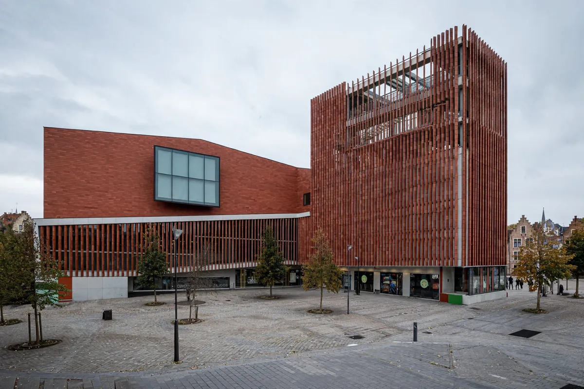
Start near Concertgebouw and walk toward the centre
The route begins at Concertgebouw Brugge and heads toward Markt through the historic centre. Follow the brochure’s sequence: cross ’t Zand, continue along Zuidzandstraat, then walk toward Sint-Salvatorskerkhof and Markt.
Visit Bruges describes the city as compact and recommends exploring on foot. Its accessible walking-route brochure is available digitally and at tourist offices, and includes practical accessibility information. The Concertgebouw Brugge guide covers the venue’s access and visitor details.
The route is designed to avoid as many obstacles as possible, but Bruges’ historic centre has many cobblestones. The city’s accessibility guide recommends taking a companion; the route can also be shortened or adapted to suit your needs.
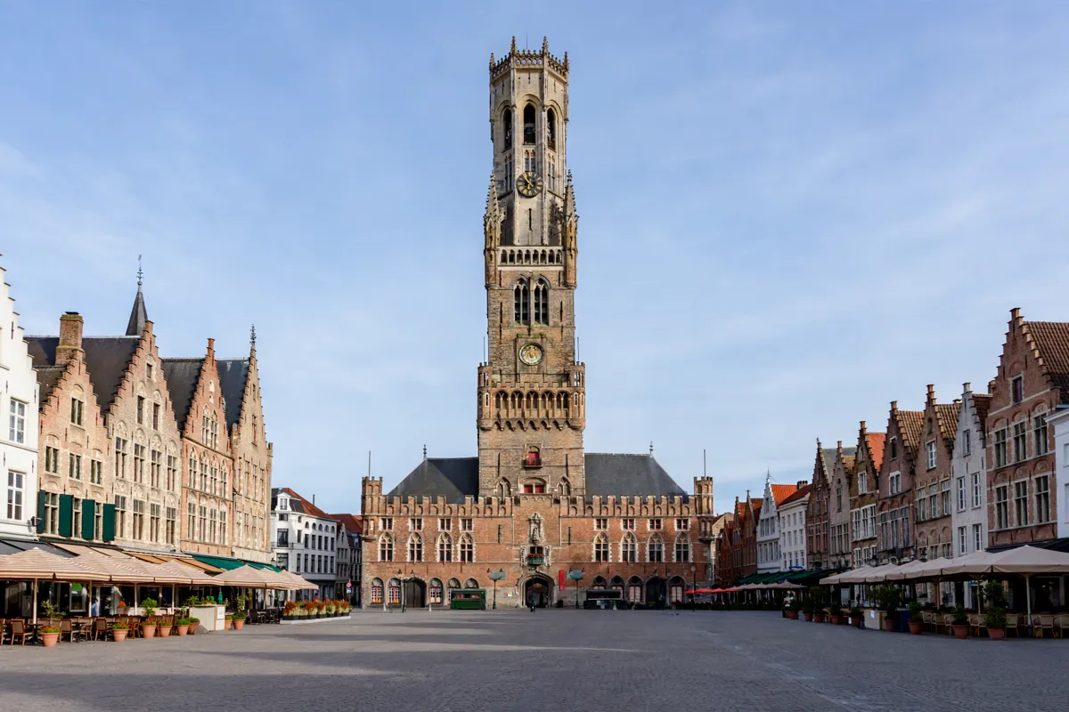
Markt and the Belfry
Markt brings together the Belfry and the square’s historic streets, making it a central stop on the route. The Belfry is an 83-metre-high, 13th-century tower at Markt 7; reaching the top involves climbing 366 steps.
A row of detectable, smooth stones runs along one side of Markt. Accessible toilets are in the City Halls’ inner courtyard and at Historium. If you want a broader sense of how the squares connect, the Bruges Old Town square-and-sights guide sets them in context.
The Belfry is not wheelchair accessible because entry and the museum involve steep stairs. The adjacent City Halls are wheelchair accessible, with lift access to upper-level halls.
Opening hours vary by season: in summer, the Belfry is open daily from 9 a.m. to 8 p.m. In winter, it is open from 10 a.m. to 6 p.m. Monday to Friday, 9 a.m. to 8 p.m. Saturday and 9 a.m. to 6 p.m. Sunday.
Last entry is one hour before closing. Standard tickets are €16 on weekends and during summer, and €15 during winter; tickets for visitors under 18 are €14, while children under 7 enter free. Check the official site before you go, as hours and prices may change.
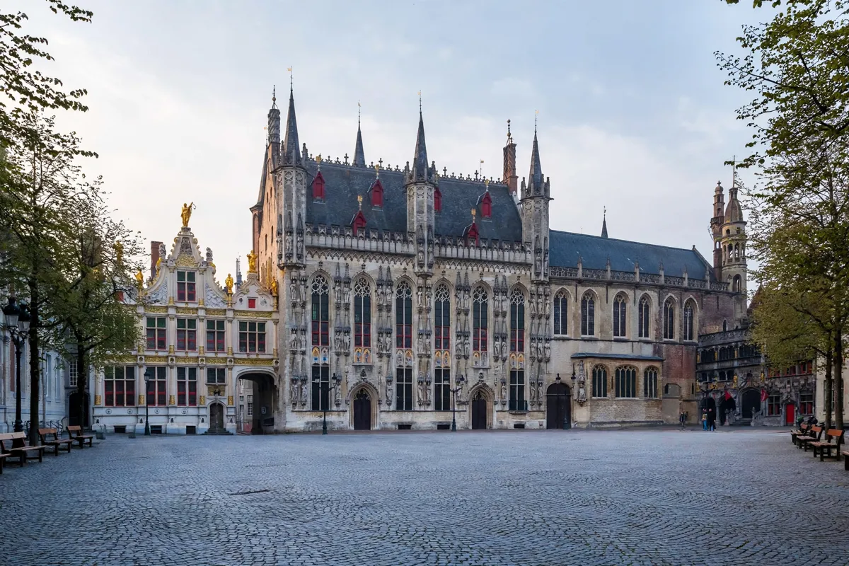
Burg Square and nearby historic façades
Burg Square follows Markt on the accessible route and is another key stop among Bruges’ monuments. The route includes the Basilica of the Holy Blood, and the square’s flat mosaic cobblestones offer a different surface from the rougher paving found elsewhere in the historic centre.
Benches stand at the Liberty of Bruges and beneath trees on the square. Visit Bruges’ free city map, available as a digital download and at tourist offices in six languages, marks facilities such as public toilets and includes detailed maps of Markt and Burg Square.
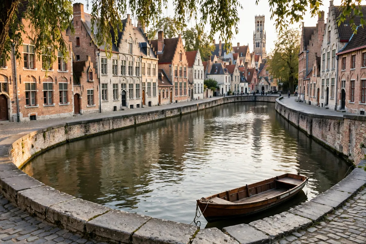
Canal-side viewpoints
Rozenhoedkaai and Dijver are the route’s canal-side stops, following the central squares. From there, the listed route continues toward Begijnhof and Minnewater, giving the walk a clear progression from Markt and Burg Square to waterways and quieter green surroundings.
The one-day Bruges route also connects the city’s walkable sights into a longer day plan.
Route length, surfaces and practical stops
The Visit Bruges accessible walking route is 3.8 km long and passes highlights in the tourist centre. Visit Bruges says the walk from Bruges railway station to Markt takes 20 minutes, which can help you plan your approach to the route.
Expect cobblestones in the historic centre, although the accessibility route is designed to avoid as many obstacles as possible. Use the brochure to plan a shorter version if needed, and consider its recommendation to walk with a companion. The free city map can help you locate public toilets and follow the detailed layouts of the main squares.
Concertgebouw Brugge is about a 2-minute walk from Hotel Leopold, a hotel near Concertgebouw Brugge, making it a convenient starting point for this walk.
FAQs
How long is the Bruges accessible walking route?
The route is 3.8 km long. It can be shortened or adapted.
Where does the route start?
It starts at Concertgebouw Brugge and continues across ’t Zand toward Markt via Zuidzandstraat and Sint-Salvatorskerkhof.
Is the Belfry accessible to wheelchair users?
No. Entry and the museum involve steep stairs. The adjacent City Halls have wheelchair access, including a lift to upper-level halls.
Can you climb the Belfry?
Yes, but reaching the top involves climbing 366 steps. Opening hours and ticket prices vary by season.